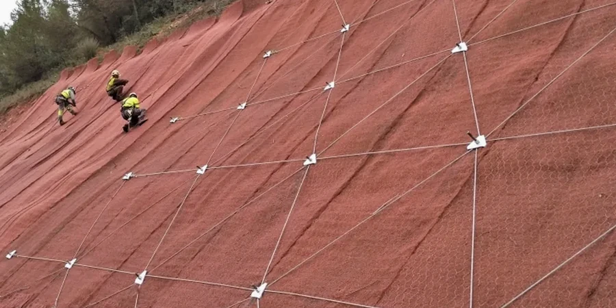
Ajax sits on the South Slope of the Oak Ridges Moraine, where the overconsolidated Halton Till meets the glaciolacustrine deposits of glacial Lake Iroquois. The waterfront bluffs along the Lake Ontario shoreline expose up to 25 metres of stratified silts and clays that remain sensitive to pore pressure changes, especially after spring melt. Any cut or fill near these slopes triggers a stability risk that standard bearing capacity checks simply do not capture. Our team has run slope stability analysis across Ajax—from the Audley Road escarpment to Duffins Creek ravines—using Spencer and Morgenstern-Price methods calibrated with lab-measured effective stress parameters. For projects near creek valleys, we often combine the analysis with test pits to confirm stratigraphy and with in-situ permeability testing to define the phreatic surface accurately before modelling.
A 1.3 safety factor in a Ajax ravine means something different than the same number in flat farmland—it is the pore pressure regime that drives the difference.
Process and scope
Local ground factors
The contrast between Ajax's dry summer creek beds and the saturated spring conditions is what makes slope stability analysis here particularly demanding. Duffins Creek and Carruthers Creek can rise more than 1.8 metres during a 48-hour rainfall event, saturating the toe and eliminating the passive wedge that kept the slope stable through the previous autumn. Lake bluff recession along the Lynde Shores area averages 0.3 to 0.6 metres per year, a rate that accelerates when wave undercutting exposes the laminated silts. Our analysis explicitly models these seasonal swings—we do not rely on a single groundwater assumption. For slopes under existing homes near Paradise Beach, we have back-analysed historical slip surfaces to calibrate the residual strength parameters, then applied those to the proposed grading plan. Ignoring the cyclic wetting-drying pattern leads to a factor of safety that looks acceptable on paper but fails within the first decade.
Reference standards
NBCC 2020 Division B, Section 4.2 (Seismic and Slope Provisions), CSA A23.3-19, Commentary on Geotechnical Aspects, ASTM D2850 / D4767 (Triaxial Compression for Effective Stress Parameters), Ontario Building Code O.Reg. 332/12, Part 4, FHWA-NHI-05-123 (Soil Slope and Landslide Stabilization)
Other technical services
Deterministic Slope Stability Assessment
Full limit equilibrium analysis using effective stress parameters from CIU triaxial tests on undisturbed samples. Includes site investigation planning, piezometer installation supervision, SLOPE/W modelling, and a signed report with clear FoS values for existing and proposed conditions. Required for site plan approval when grading within 15 metres of a ravine crest in Ajax.
Erosion-Driven Stability & Setback Study
Combines geomorphic observations, wave climate data for Lake Ontario bluffs, and unsaturated soil mechanics to define a long-term stable slope inclination and recommended setback distance. Particularly relevant for waterfront properties south of Bayly Street and for creek crossings where scour undermines the slope toe.
Typical parameters
Questions and answers
How much does a slope stability analysis cost for a residential property in Ajax?
For a single detached lot near a ravine or bluff in Ajax, the analysis typically ranges from CA$1,650 to CA$5,910. The spread depends on whether existing borehole data is available, how many cross-sections need modelling, and whether piezometer monitoring over a wet season is required to satisfy the town's peer reviewer.
What factor of safety does the Town of Ajax require for slope stability?
The Town of Ajax follows the Ontario Building Code, which mandates a minimum factor of safety of 1.5 for permanent slopes under static conditions. For temporary construction slopes open less than 6 months, a FoS of 1.3 is generally accepted, though the geotechnical engineer must justify it with site-specific data.
Do you need to drill boreholes for a slope stability analysis, or can you use existing data?
Existing borehole logs from neighbouring properties help during the desk study, but we almost always need at least one new borehole at the crest and one at the toe to capture the complete stratigraphy. Undisturbed Shelby tube samples are essential for measuring the peak and residual strength of the Halton Till and underlying glaciolacustrine units—without them, the analysis relies on conservative assumptions that may unnecessarily restrict the building envelope.
How long does a slope stability report take from start to finish?
A typical timeline for an Ajax slope stability report is 4 to 6 weeks. The first week covers utility locates and drilling, the second and third weeks are for laboratory triaxial and Atterberg testing, and the final two to three weeks are for modelling, drafting cross-sections, and peer review. If piezometer monitoring over a spring thaw is required, the report may extend to 8 weeks to capture the critical groundwater condition.