Ajax started expanding fast after WWII, and much of the town sits on glacial till overlying shale bedrock. This means the subsurface varies sharply in short distances, making traditional drilling alone risky. Our electrical resistivity surveys and VES tests cut through that uncertainty. We measure apparent resistivity at depth without trenching or coring, so you get a clear picture before the backhoe arrives. Resistivity profiling works well here because the saturated clays near Lake Ontario contrast sharply with dry sand lenses further inland. For shallow investigations we pair the VES with a test pit program to calibrate resistivity with actual soil texture, while deeper campaigns often tie into SPT drilling for correlation with N-values.
In Ajax, a 200-meter resistivity line can reveal the shale bedrock profile faster than three boreholes and costs a fraction of the mobilization.
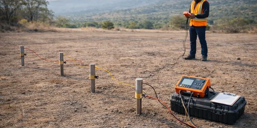
Process and scope
- Non-invasive surface measurements, no heavy equipment needed in tight backyards.
- Schlumberger and Wenner arrays: we configure based on target depth.
- Data inversion with RES2DINV or equivalent software.
- Integrated interpretation with borehole logs from CPT testing when available.
Local ground factors
We worked on a commercial building site off Harwood Avenue where initial grading exposed what looked like uniform clay. The structural engineer suspected buried organics from an old creek bed. A quick 2D resistivity line showed a low-resistivity lens at 3 meters depth, right under the proposed footing. The contractor excavated it and replaced the material before pouring concrete. Without that survey, they would have poured on compressible fill and faced settlement cracks within two years. In Ajax, ignoring resistivity data in low-lying areas near Duffins Creek or the lake plain means gambling on undetected soft zones. The technique also flags groundwater perched on shale, which matters for dewatering plans and basement waterproofing.
Video overview
Reference standards
ASTM D6431-18 Standard Guide for Using the DC Resistivity Method, ASTM D5777-18 Standard Guide for Selecting Geophysical Tools, Ontario Building Code (OBC) references to subsurface investigation, CSA A23.3 for reinforced concrete design (when resistivity informs corrosion risk)
Other technical services
Vertical Electrical Sounding (VES) for Stratigraphy
We deploy a Schlumberger array at a fixed center point, expanding electrode spacing to map resistivity versus depth. Ideal for estimating bedrock depth and identifying aquifer layers before drilling.
2D Resistivity Profiling for Site Characterization
Multi-electrode Wenner or dipole-dipole lines provide continuous cross-sections across the property. We use this to locate buried channels, contamination plumes, or karst features in the limestone east of Ajax.
Typical parameters
Questions and answers
How much does a resistivity survey cost in Ajax?
A single VES sounding typically runs CA$850–CA$950, while a 200-meter 2D line with processing ranges from CA$1,150 to CA$1,350. The final figure depends on line length, electrode count, and terrain access. We provide a fixed quote after reviewing your site plan.
Can resistivity testing locate groundwater in Ajax?
Yes. Saturated clays and sands show low resistivity, so the method maps water table depth and confined aquifers. In Ajax, the contact between dry till and saturated deposits is usually sharp and easy to interpret.
What is the difference between VES and 2D profiling?
VES gives a 1D resistivity curve at a single point to interpret vertical layering. 2D profiling uses multiple electrodes along a line to produce a cross-section. We recommend VES for deep targets and 2D lines when lateral changes matter most.